Quantcast
Channel: INDONESIA'S URBAN STUDIES
Viewing all 43 articles
Browse latest View live

Traffic and Change of School Start Time

$
0
0
A policy proposed by the Jakarta city administration to advance the start of school hours from 7:00 a.m. to 06:30 a.m. sparked controversy from the public. The policy that was aimed at overcoming the traffic congestion in the capital will be at the expense of students. The City Council rejected the idea and argued it will not address the problem of traffic congestion. Meanwhile, the city administration predicted the policy will reduce congestion by between 6 and 14 percent (The Jakarta Post 27 November 2008).


Setiabudi Macet 1, originally uploaded by susiloadhy.

Opponents of this policy argued this policy was only another strong evidence of the inability of the government of Jakarta to overcome traffic congestion. Students will be required to wake up early in the morning and they will be sleepy in class. The proposed policy will cause the tardiness of many students and many classrooms will be empty in the morning.

Given the limitation of the Jakarta city administration in overcoming traffic congestion, the policy to change school start time should be considered as a creative and innovative policy. The reaction to this controversial policy from the public should be anticipated by the city administration. The city administration Jakarta government must implement this policy consistently while still working to reduce traffic congestion through other policies.

The traffic congestion in the capital, especially in the morning, will be slightly
reduced through this policy. The intensity of traffic jams in the capital in the peak hours will decrease because of the thirty minutes early trips of the studetns. The argument of the policy will reduce traffic congestion by 14 percent is reasonable. Data Pokok Kependidikan (Primary Data of Education) from the Jakarta's Office of Secondary Education shows that 1.75 million or 21 percent of the 8.3 million inhabitants living in Jakarta in 2006 are school aged people of 7-18 years old.

The traffic congestion in the capital can't be separated from the high rate of vehicle ownership by 9-11 percent per year that is not supported by the growth of road developent which is only less than 1 percent per year. The development of mass transportation system in the capital is still far from the expectation. The busway can reduce the intensity of traffic congestion in the main roads in the city center, but it has still yet to much untangle traffic congestions in other parts of the capital. In addition, the Mass Rapid Transit (MRT), which has long been planned, is stil unclear when to be realized.


Why you should use the Jakarta busway, originally uploaded by fishkid.

The high rate of vehicle ownership and the high urbanization in the greater Jakarta area is also the results of the role of Jakarta as the capital of Jakarta and the country's economy and business center. Resolving the transportation problems in Jakarta must also consider developments occurring in the Jakarta's neighboring areas.

Given the various limitations in overcoming traffic congestion through the development of mass transportation system and the high rate of vehicle ownership motor vehicles that is difficult to be controlled, the plan to change school start time is an innovative and creative solution. It is better to implement this policy rather than waiting for the completion of the mass transportation system or the more road built in Jakarta.

In the early implementation of this policy, the city administration needs to tolerate the tardy arrivals of students to schools since the students and parents need some time for the adjustment to the early school hours. Similarly, the availability of public transportation in the early morning needs to be secured to provide services for the students.

In the next stage, the city administration needs to develop school buses that provide shuttle services for students. The provision of school buses will significantly reduce congestion because it will be reduce the number of private vehicles that were previously used to transport the students.

Other alternative that can be considered to reduce congestion school is to implement school attendance zone (rayonisasi). This policy will limit students in their choice of schools. The priority will be given to students who reside near the school. The implementation of this system will shorten the trip distance from the student residence to school, and will ultimately reduce traffic congestion.

In addition, the coordination of the school provision among the municipalities in the Greater Jakarta area needs to be strengthened. The availability of good schools in the Jakarta suburbs is very essential and it will prevent the residents in the suburbs of Jakarta from sending their children to better schools in the central city of Jakarta. The availability of good schools in the buffer areas of Jakarta will ultimately reduce the transportation problem in the capital.

(This article also appeared at The Jakarta Post on December 20, 2008)


Economic Crisis and Public Works Projects

$
0
0


city (11)1, originally uploaded by budibudz.


This year is an important year for policy makers for overcoming the global economic crisis that started from the financial crisis in the United States in the early 2008. The policy made in the beginning of 2009 will influence the future of the world's economy. In the United States, people have a high expectation on public works projects proposed by the Obama administration to overcome the economic crisis.

Barack Obama promised to build public works projects, the largest investment since the creation of the interstate highways fifty years ago. Public works projects are believed to revive the economy by creating new employments. In a meeting with Barack Obama in early December 2008, the US governors submitted the public works proposals that are ready to go in total amount of USD 136 billion including roads, bridges, etc. Those projects will create about 40,000 jobs for each USD 1 billion.

Lessons from the Great Depression
The current economic crisis is still less severe than the Great Depression in the 1930s, at least from the unemployment rate. In the 1930s, the unemployment rate reached nearly a third of the American workers. The current unemployment rate in the US at the end of December 2008 was 7.2% which was the highest record in the last 16 years, and this number is still very likely to increase. The current crisis has made economists and politicians think hard to avoid the second edition of the Great Depression.

In resolving the Great Depression, President Franklin D. Roosevelt created the New Deal including the creation of jobs through public works projects in most parts of the US. One of the projects is Tennessee Valley Authority (TVA) that built dam in the Tennessee rivers and several hydroelectric projects in the Tennessee region, one of the poorest region in the US. The history shows that the New Deal was able to address the Great Depression. In addition, TVA was able to create an energy source and 30,000 new jobs and also improve the quality of live of people in the Tennessee region.

An important principle of the programs developed by the FDR administration in addressing the Great Depression is the government intervention to the free market. This principle is an implementation of the advice of John Maynard Keynes, an interventionist government policy. The Keynesian economics will also be implemented by the Obama administration to resolve the current economic crisis.

Lessons for Indonesia
What can Indonesia learn from the global economic crisis? Learning from the success of the New Deal and the implementation of the Keynesian economics, it is clear that the government intervention is very vital to address the current economic crisis.

The budget of development that has been appropriated in the national budget (Anggaran Pendapatan dan Belanja Nasional) should be used for the real sectors, particularly in the regions of high unemployment rates. The public works projects, like TVA, such as dam and irrigation for extensifying agricultural lands outside the island of Java is quite relevant for the current situation in Indonesia. The extensification agricultural lands projects can also be directed to reduce the burden of Java island as the primary provider of the national food and alleviate poverty outside Java island.

If Indonesia wants to copy the green development initiatives as proposed by the Obama administration, Indonesia can develop a mass transportation system and alternative energy innovation projects. In the meantime, the conventional public works projects such as roads and bridges need to be focused on repairing the broken and bad infrastructures rather than developing new infrastructures.

(This post is an English version of the original article that appeared in the daily newspaper of Media Indonesia on January 15, 2009).

Jakarta Annual Flooding in February 2009

$
0
0
February is the month when rainfall in Jakarta and other areas in Indonesia are highest and floods become a threat for residents. This year’s February also witnessed floods in many parts of Jakarta including sub-districts Bidara Cina, Kampung Melayu, Cawang, Bukit Duri, Angke, Petamburan, Tanjung Priok, Kelapa Gading, Koja, Cilincing, Rawa Badak, Kamal Muara, and Kapuk Muara. These areas were inundated by between 10 and 50 centimeters of water. Floodwaters also caused lengthy traffic jams in many main streets in Jakarta.

neighborhood., originally uploaded by omae.
Fortunately, the extent of this year’s flooding was not as great as in the last two years. In February 2007, the worst flooding in Jakarta's history inundated about 70 percent of the city, killed at least 57 people and sent about 450,000 fleeing their homes. In February 2008, 37 of 267 subdistricts in Jakarta were inundated by more than 40 centimeters of water. Floodwaters caused public transportation, including the busway lines across Jakarta, to stop operations, leaving thousands of passengers stranded. Last year’s flood also inundated the Sedyatmo toll road to Soekarno-Hatta International Airport, which resulted in the cutting off the highway for a few days. Nearly 1,000 flights were delayed or diverted and 259 flights were canceled.

Interestingly, this year’s rainfall in Jakarta is higher than that in 2008 and is about the same with the 2007 rainfall. This year’s highest rainfall per day happened on February 2, 2009 reaching 339 millimeters. This year’s highest daily rainfall is slightly higher than that in 2007 (317 millimeters) and much higher than that in 2008 (117 millimeters). It is important to note that the high rainfall in the Jakarta’s neighboring areas was also blamed for the major flood in 2007.

In response to the last year's flood, Governor Fauzi Bowo set several strategic measures including ensuring the early warning systems are effective, dredging the river to enable the water flow properly, revitalizing the Pluit, Sunter and Riario dams, and placing mobile water pumps on the Sedyatmo toll roads to anticipate the blackouts. I would argue that the low enormity of this year’s flood is also subject to the effectiveness of such measures. Such measures may be able to mitigate the impact of this year’s flooding, but still cannot prevent the flooding.


Canal - Jakarta, originally uploaded by pyjama.
Jakarta has 18 main canals and 500 smaller canals of 2 to 15 meters in width. The Jakarta’s network of canals performed only 50 to 70 percent of its capacity because these canals have been silted up with 9 million cubic meters of sediment and garbage (The Jakarta Post, February 2, 2009). Furthermore, Budi Widiantoro of the Jakarta Public Works Agency blamed the garbage as the main cause of the low capacity of Jakarta’s canals (The Jakarta Post, January 14, 2009). This is certainly a big challenge for the Jakarta administration to educate its residents to not throw away garbage into canals. Dredging canals will not be an effective way of reducing flood if people still throw away garbage into canals.

In the aftermath of the 2002 major flood, the central government and Jakarta administration plan to build the East Flood Canal project. The project is aimed at reducing floods in a 270-square-kilometer flood-prone area of East and North Jakarta, but it has progressed very slowly. As of February 2009, the Jakarta administration has procured only 62 percent of the needed land. The East Flood Canal is sought to be most feasible solution for preventing future flooding in Jakarta, but apparently the East Flood Canal is not easy to be materialized.

Neither dredging the canals and rivers nor building new canals is a sustainable solution for preventing future flooding in Jakarta. As the economic, commercial, cultural and transportation hub of the nation, Jakarta is poised to grow faster than other parts of Indonesia. The annual floods are strong evidence that Jakarta cannot sustainably accommodate its rapid growth. Indonesia needs to redistribute the central functions from Jakarta to other parts of the nation and create more urban agglomerations to pull urban growth away from Jakarta. Relocating central functions out of Jakarta will reduce the rapid growth in Jakarta and eventually become a sustainable solution for preventing future flooding in Jakarta.

(This article also appeared at The Jakarta Post on February 28, 2009)

The Collapse of Situ Gintung Dam and Poor Enforcement of Spatial Plans

$
0
0
The Situ Gintung dam in Cireundeu, Tangerang broke on March 27, 2009 and killed at least 99 people (Kompas April 1, 2009) and still counting since there are about 100 people reportedly missing. The dam was built during Dutch colonial rule to contain water from the Pesanggrahan River. Several investigations have been conducted to identify the culprit of the of the Situ Gintung collapse. The Indonesia Technology Application and Research Agency (BPPT) revealed piping in the body of the dam (Kompas April 1, 2009). The piping allowed water infiltration into the capillary breaks that caused the dam collapse. The piping was identified in the month of December 2008.


Situ Gintung Tragedy -another-, originally uploaded by aris-ressy.


The heavy rain in the area of Situ Gintung was often blamed by many people as the culprit of the disaster. The heavy rain is only a trigger but is not a cause of the dam collapse. Heavy rains were often recorded in the Situ Gintung area, as happened in 2007 that caused big floods in Jakarta, but they did not break the Situ Gintung dam.

I would argue that the collapse of the Situ Gintung dam was caused by the low enforcement of the spatial planning laws in Indonesia. Indonesia has had spatial planning laws since 1992 through the enactment of the spatial planning law 24/1992. This spatial planning law differentiated spatial plans by two main functions including conservation areas (kawasan lindung) and cultivation areas (kawasan budidaya). Conservation areas include areas surrounding springs and lakes such as the Situ Gintung area. The spatial planning law 24/1992 clearly stipulated that the conservation areas have the main function for protecting the environmentally sensitive areas such as areas surrounding springs or lakes. Activities that are allowed in the conservation areas are very limited including conservational and rehabilitation activities, research and environmental tourism.

Referring to the spatial planning law 24/1992 or the current spatial planning law 26/2007, the Situ Gintung area was supposed to be a conservation area. Assigning the Situ Gintung area as a conservation area means only activities protecting the environmentally sensitive area of Situ Gintung will be allowed in the area. Residential areas will not certainly be allowed in the conservation areas including in the Situ Gintung area.

The disaster of Situ Gintung is the impact or negative externalities of the activities in the area that cannot protect and conserve the environmentally sensitive area of Situ Gintung. More than 40 percent of the 112.5 hectare water catchment area of the Situ Gintung was identified as residential areas (Kompas April 1, 2009). Such a large proportion of residential areas in an environmentally sensitive area are clearly an indication of the low enforcement of spatial planning laws. It is very likely that the residential areas would expand in the Situ Gintung area in response to the population growth if the disaster did not happen.

The current spatial planning law 26/2007, adding several clauses from the spatial planning law 24/1992 such as imposing administration and criminal sanctions for those who violate the laws, is poorly enforced. The new stipulations in the spatial planning law 26/2007 including disincentive and incentive in the spatial plan implementation have not been fully enforced. The violation of spatial plan law in the Situ Gintung area is only one of many violation cases in Indonesia. The Indonesian Planning Association also acknowledged the spatial plan law violations in other Indonesian cities in their press release in the aftermath of the disaster of Situ Gintung. The enforcement of the spatial planning law will be a difficult task without the understanding of residents about the importance and essence of spatial plans.


Situ Gintung Tragedy, originally uploaded by aris-ressy.


Indonesian people need some more time and efforts to “learn” the importance of spatial plan for the sustainable development in Indonesia. The disaster of Situ Gintung should be interpreted as a learning process for Indonesian people about the consequences of the spatial planning law violation. Indonesia needs to learn from the mistakes in the Situ Gintung case for preventing similar cases in the future. Indonesian people need to understand the importance of spatial plans for their public health, safety and welfare. Such an understanding is quite important for the Indonesian governments to enforce the spatial planning law 26/2007 in order to create safe, convenience, productive and sustainable places in Indonesia.

Envisioning City without Cars

$
0
0
Traffic congestion is one of the chronic problems in most Indonesian cities and this problem is getting worse year by year. The growth of road developments in Indonesian cities is much slower than the growth rate of vehicle ownership. In Jakarta, for example, the growth rate of vehicle ownership is 9 to 11 percent per year but the growth of road developments is only less than 1 percent per year.


Setiabudi Macet 1, originally uploaded by susiloadhy.

When a new highway was built or a road was widened, it will only solve the traffic congestion for a short period of time. After a few years, the new highway will fill with traffic that would not have existed if the highway had not been built. Similarly, the widened road fills with more traffic in a few months. Such phenomenon is called induced demand. Because of the induced demand, neither building new roads nor widening roads are the long-lasting solution to traffic congestion.

There are several possible solutions to eradicate traffic congestion problems and one of them is the reduction of private vehicle uses. I read an article in the New York Times (May 12, 2009) on a suburb town without cars in Germany with great interest. Streets in this upscale town are completely car-free except the main thoroughfare and a few streets on on edge of the town. The residents of this town are still allowed to own cars, but parking is relegated to two large garages at the edge of the development.

The Vauban town, is located on the outskirt of Freiburg, near the French and Swiss borders and home to 5,500 residents. The residents are heavily dependent on the tram to downtown Freiburg and many of them take to car-sharing when longer excursions are needed. Seventy percent of Vauban's families have no cars. They do a lot of walking and biking to shops, banks, restaurants, schools and other destinations that are interspersed among homes. The town is long and relatively narrow and provides an easy walking access to the tram for every home.

Creating places with more compact design, more accessible to public transportation and less driving is the envision of urban planners in the 21st century. The Vauban town is an exemplar of the 21st century urban design in response to the threats of greenhouse gas emission and global warming and the dwindling oil supply.

I could argue that the Vauban's urban design is the extention of the New Urbanism. The New Urbanism is a school of urban design arose in the U.S. in the early 1980s. This school of urban design promotes several key principles including walkability and connectivity, mixed land uses, and high density. There have been many the New Urbanist towns in several countries, but cars still fill the streets of these towns.

The Vauban town provides an example of the possibility of creating city without cars. The walkable and mixed-land-uses urban design, easy access to public transportation and excellent public transportation system as demonstrated in the Vauban town are the components for creating city without cars.

Cars are still a luxury item for many Indonesian families. Many urban residents, particularly those live in kampung kota, do not own cars and are used to living without cars. Streets (gang) in Indonesia's kampung kota are too narrow for cars and the residents are used to walking and biking to their destinations. Kampung kotas are located in the center of urban areas and relatively accessible to public transportations. In reference to the New Urbanism concept, the Indonesia's kampung kota has implemented the principles of walkability and high density.

Indonesian planners need to appreciate the existence of kampung kota in terms of lacking driving needs. Kampung kota residents will be less likely to have a demand for cars when their neighborhoods are accessible to public transportations and the streets in their neighborhoods remain narrow. Kampung kota residents need to remain lack of driving needs for reducing the car ownership rate in urban areas.

For new developments in suburb areas, Indonesian planners can emulate the success of the Vauban town. Driving needs are profoundly affected by the urban design and the high access to public transportation. It makes sense to envision and is not all impossible to create a city without cars.

(This article also appeared at The Jakarta Post on June 2, 2009)

This blog in the GPEIG Newsletter

$
0
0


amazing, originally uploaded by BESTPHOTO.

In the early September 2009, I received an email from Dr. Vinit Mukhija, an associate professor of urban planning at UCLA who is also a co-chair of GPEIG, that invited me to submit a story about this blog for the GPEIG newsletter. I was certainly delighted to accept the invitation and submitted a description about the blog and my reflection on blogosphere two weeks later to him.

GPEIG stands for Global Planning Educators Interest Group and is an interest group under the ACSP (Association of Collegiate Schools of Planning). The mission of GPEIG is to foster global perspective in planning education and research. This link provides more information about GPEIG.

Following is the story about this blog in the GPEIG newsletter that can also be found in this link.

I am honored to share my blog of Indonesia’s Urban Studies with the readers of
the GPEIG newsletter. The blog, located at http://indonesiaurbanstudies.blogspot.com/ was created in January 2007. As mentioned in the first post of my blog, the purpose of this blog is to contribute to the advancement of urban studies and planning in Indonesia, and was inspired by the success of Randall Crane’s blog of Urban Planning Research.

My blog includes a wide-ranging collection of reflections and essays about urban issues in Indonesia, including poverty, informal sector, transportation, land uses, spatial planning, urban primacy and global warming. My reflections are primarily focused on the current urban issues in Jakarta and are based on my regular reading of two Indonesian newspapers, Kompas and The Jakarta Post. Most news stories in both newspapers are about Jakarta, and a few stories are about other cities in Indonesia. That’s why my blog posts are mainly about Jakarta.

Several urban issues in Jakarta are discussed in my blog, including the banning of
motorcyclists from Jakarta’s main roads, extortion by thugs of street vendors, an upscale neighborhood’s resistance against a new busway corridor plan, the Jakarta City Council’s rejection of a plan of converting gas stations into green areas and the change of the school start time. The blog also includes the reflections of the last three years of annual floods that inundated Jakarta. Interestingly, the floods always occurred in the first week of February. The blog documents the impacts of the flood each year and government efforts at preventing the floods. These posts were also submitted to and run by The Jakarta Post in its Op-Ed sections.

The blog also presents a number of essays including the history of urbanization and
suburbanization in Jakarta, the dominance of Jakarta in Indonesia’s economy,
urban planning and the informal sectors in developing countries, challenges of the planning profession in Indonesia, and a book review of Christopher Silver’s Planning the Megacity: Jakarta in the Twentieth Century.

Nearly 50,000 visitors have come to my blog and most of them are via Google. Many visitors also came from other websites and blogs that have a link to my blog, including the ACSP’s website. A number of students from many parts of the world contact me after visiting my blog for a variety of reasons, including asking further questions or for detailed data, asking for data sources in Indonesia, asking for definitions of urban terms, asking me to review their work on Indonesia, or simply for appreciating my work. In addition to students, a journalist of Singapore’s The Straits Times and a Norwegian journalist contacted me for their stories of Jakarta. I was also invited by the editors of an Australian magazine and several Indonesian newsletters to submit stories about urban issues in Indonesia. All these invitations and interviews came to me through visits to my blog.

Furthermore, I can trace from where and how long the visitors visit my blog. They come from countries all over the world, including countries in Africa and South America. I am amazed by their interest in Indonesia’s urban issues, and hope that my blog contributes to their interests.

When I started nearly three years ago, I never expected to get what I have accomplished with my blog today. We can witness the power of the Web in building and shaping our society. The world is now directed by the citizens of the new digital democracy. Blogging is a good way for scholars to be a part of this new world of digital democracy. I have learned from my blog that the voice of scholars in the blogosphere is well-respected and appreciated. The blog audiences have a lot of choices to read and they find the voice of scholars worth reading.

A city without social justice: Jakarta needs more green space, but not the expense of the poor

$
0
0
This post was published in Inside Indonesia, an Australian magazine, in the October-December 2009 edition. Following is the link to the article:
http://insideindonesia.org/content/view/1246/47/


DSC01412, originally uploaded by Luis XII.

In case of the link is not available, I copied the article as you can find below. Thank you.


A city without social justice: Jakarta needs more green space, but not the expense of the poor

Jakarta is not only Indonesia’s capital and most dynamic city, it is also beset with a plethora of 21st century urban problems. As its population grows, its green spaces shrink. In the first half of the twentieth century Batavia, colonial capital of the Netherlands East Indies, was a small urban area with approximately 150,000 residents. Batavia has become Jakarta, Indonesia’s megacity of 14 million.

Green spaces in the city have shrunk along with this leap in population. As recently as 1965, green areas made up more than 35 per cent of Jakarta’s land area. Currently, they account for only 9.3 per cent, far below the target of 30 per cent set by Law No 26 of 2007 on Spatial Planning.

Shrinking green areas
As Jakarta is certain to continue to grow, the city’s master plan to protect remaining green spaces and add some more, especially along riversides, offer some hope. The city’s current 2000-2010 master plan aims to achieve green areas (legally defined as areas where plants can grow) of 13.94 per cent of the total city area. This is an excellent goal, but it is modest when we compare it to similar plans in the past. The 1965-1985 master plan, for example, planned for green areas covering 27.6 per cent of Jakarta’s land area. In part, these plans are simply catching up with reality. New luxury homes, condominiums, shopping malls, hotels, commercial buildings and offices have proliferated in Jakarta over the last three decades. Many have been built at the expense of green areas and have paved over water catchment areas, making the city more prone to floods.

Annual floods in Jakarta point to an urgent need to protect existing green
areas in the capital – and to create new ones.

Not surprisingly, annual floods are becoming more severe, and more deadly. The worst flood in memory occurred in February 2007, inundating about 70 per cent of the city. It killed at least 57 people and sent some 450,000 fleeing their homes. In the aftermath of the flood, Environment Minister Rachmat Witoelar put the blame on excessive construction of residential and commercial buildings, which now cover many of the city’s former green areas.

Annual floods in Jakarta point to an urgent need to protect existing green areas in the capital – and to create new ones. Green areas absorb rainwater and thus help prevent flooding. Green areas also help make cities more sustainable and livable.


Canal - Jakarta, originally uploaded by pyjama.

Clearing out the poor
As part of its master plan, Jakarta’s administration has planned to expand the city’s green areas to nearly 14 percent of the city’s area by next year. However, even this modest expansion will come at the expense of some of Jakarta’s most powerless residents. Often, when the city government creates new green spaces it does so by evicting the city’s poor residents and operators of informal sector businesses.

For example, the restoration of Ayodia Park (on Jalan Barito in South Jakarta) led to evictions of fish and flower traders in January 2008. Many of the traders had run their businesses in that area for more than 20 years, yet Jakarta Governor Fauzi Bowo argued that the vendors were there illegally and had no right to the land. In February 2008, the city administration evicted ceramics sellers from beneath a highway overpass in Rawasari, Central Jakarta, in order to expand green spaces. It did the same to about 1400 families who had lived for years in Kampung Bayam (North Jakarta) in August 2008. In this case the aim was to restore the 66 hectare BMW Park (BMW in this case stands for Bersih, Manusiawi, dan Wibawa – Clean, Humane, and Esteemed). The Kampung Bayam eviction turned into a melee as many squatters, mostly women and children, resisted officers’ efforts to remove them.

While Jakarta authorities often use force to ‘free’ land used by the city’s poor, they lack the courage to prevent construction of the condominiums, malls, hotels and commercial or offices that developers and the rich build in designated green areas in blatant violation of the city’s spatial plans. The Indonesian Forum for the Environment (WALHI) counted numerous Jakarta developments that converted green areas into malls and other commercial buildings, in violation of Jakarta’s spatial plan. WALHI’s May 2009 report identified these illegal developments in Kelapa Gading, Pantai Kapuk, Sunter, Senayan, and Tomang. Governor Fauzi Bowo told the media in February 2008 that it would not be realistic to demolish such buildings to restore green spaces.

The authorities often use force to ‘free’ land used by the city’s poor, but they
lack the courage to prevent construction of condominiums, malls, hotels,
commercial buildings and offices

Jakarta now has about 60 mid-size and large shopping malls. According to the Urban Poor Consortium (http://www.urbanpoor.or.id/ ), a Jakarta advocacy organisation, only about 500,000 Jakarta residents can afford to shop in those malls. The malls do not serve Jakarta’s poor, who outnumber Jakarta’s mall-shopping rich by seven-to-one.

Social injustice
Not only has the Jakarta government failed to prevent the loss of existing green spaces to malls and commercial buildings, influential commercial interests have also scuttled plans to re-establish green spaces. For example, in March 2008, Jakarta’s City Council rejected the Jakarta Parks Agency’s plan to create green spaces in place of 29 gas stations, caving in to the demands of the politically powerful gas station owners.

The city administration deserves support for planning to create additional green spaces.But it should not do so by mistreating poor people and the informal sector. It seems that Jakarta politicians find it easier to expand green areas by demolishing poor residents’ homes and forcing informal sector workers off public space, than by preventing, stopping, or demolishing developments that benefit only the wealthy.

Deden Rukmana (rukmanad@savannahstate.edu) is assistant professor and coordinator of the graduate program in Urban Studies and Planning at Savannah State University, USA. He publishes Indonesia’s Urban Studies (http://indonesiaurbanstudies.blogspot.com/ )

Restoring Green Areas in Jakarta

$
0
0

New Style Gas Station, originally uploaded by cyberlucky.


On November 8, 2009 Jakarta’s Governor Fauzi Bowo closed and locked a gas station located on Jl. Jendral Sudirman to symbolically close down 27 gas stations and convert the areas into green spaces. The Jakarta Parks and Cemetery Agency announced that the 27 gas stations will be closed by the end of the year and the closure of these gas stations will add another 10,505 square meters of green areas in Jakarta (The Jakarta Post, November 11, 2009).

The conversion of gas stations into green areas is to meet the target for green areas in Jakarta stipulated in the Jakarta spatial plan 2000-2010 to cover 13.94 percent of Jakarta's total 63,744 hectares by 2010. In 1965, green areas made up more than 35 percent of Jakarta and have been shrinking ever since. Currently, green areas in Jakarta account for only 9.3 percent of the city's area, far below the target of 30 percent set by the Spatial Planning Law 26/2007.

I commend Governor Fauzi Bowo and his city administration for converting gas stations into green areas because of two main reasons. First, the conversion of gas stations into green areas is a good precedent for implementing spatial plans. Over the years, the spatial plan seems to be a legal document that is not fully enforced and implemented. The 27 gas stations are located in the areas designated as green areas in the Jakarta spatial plans 1965-1985, 1985-2005 and 2000-2010. For many years, the city conceded to the powerful owners of the gas stations and could not enforce and implement the spatial plans. In March 2008, the city proposed the plan of the gas stations conversion but it was rejected by the Jakarta City Council. This year, the city resubmitted the proposal and it was approved by the newly elected Jakarta City Council.


city (4)1, originally uploaded by budibudz.

Second, we must put a stop to disappearing green areas in Jakarta. Green areas are an important urban element that can help make cities self-sustainable and more livable. Annual floods in Jakarta indicate an urgency for green areas in the capital, because they absorb rainwater and help to avert flooding. New homes, condominiums, malls, hotels and commercial and office buildings have proliferated in Jakarta over the last three decades. These new developments have come at the cost of green areas and have decreased water catchment areas, making the city more prone to floods. Not only will the conversion of gas stations into green areas add the green areas but also contribute in preventing annual floods in Jakarta.

The cost of closing down and converting each gas station was around Rp. 75 million and I would argue that the benefit of the conversion of gas station into green areas will be much more than Rp. 75 million over the years. In addition to reducing the risk of floods, the new green areas will beautify and make Jakarta more livable. I would also suggest that the green areas that are close to residential areas be designed as recreation parks. The recreation parks will serve as a mode to build healthy, strong and vibrant neighborhoods and it will benefit the city even more. The conversion of these gas stations into green areas will also restrain the increasing city's carbon dioxide levels. The green areas can serve act as sponges for such pollutants.

In sum, the decision of the Jakarta’s administration to close down the gas stations and convert them into green areas in order to comply with the Jakarta spatial plan is a good move and should be appreciated. Not only will this decision become a good precedent for implementing the spatial plans in Jakarta or even in other areas in Indonesia, but also will provide a lot of benefits for the city and its residents.

(This article also appeared at The Jakarta Post on December 12, 2009; was reposted at Creative Cities ; was cited at Treehugger and at Reflection on Auckland Planning )

Climate Change and Urban Development

$
0
0


Welcome-to-the-Greenhouse, originally uploaded by mix's.

This post is an English version of my article published in the Indonesian newspaper of Kompas on Tuesday, December 15, 2009.

The attention to climate change and global warming is now on the United Nations Climate Change Conference in Copenhagen, Denmark on December 7-18, 2009. This conference is expected to reach a new agreement on decreasing global emissions of greenhouse gases after the ending of the Kyoto Protocol in 2012.

As one of the tropical countries with large forest areas, Indonesia is expected to play an important role in absorbing the emissions of carbon dioxide that cause the increase of greenhouse gases in the atmosphere. Transtoto Handadhari (Kompas, December 7, 2009) reported that Indonesian forests have the carbon dioxide absorption as many as 25,733 billion tons excluding peat forests and dry lands. The government of Indonesia set a target of reducing the carbon emissions by 26 percent in 2020 through many ways including the expansion of new forests as much as a half hectare per year, the expansion of community forests about 4 million hectares, and the decrease of hot spots about 20 percent.

The decrease of carbon dioxide emissions for addressing the global warming is not only the responsility of those who work in forests, but also that of all citizens. Urban residents play also an important role in decreasing the carbon dioxide emissions. Human activities that use fossil fuel are a big contributor in the global warming. Increasing the efficiency of electricity uses such as lighting, cooling or the uses of electronic tools and recycling are some ways that can be offered to address the global warming.


Copenhagen UN Climate Change Conference, originally uploaded by United Nations Photo.


Urban Green Areas

Urban development can be also aimed at addressing the global warming. Urban green areas are often sacrificed in urban developments in order to keep up with the fast-growth of urban population. Jakarta, for instance, in 1965 had green areas as much as 30% of the total Jakarta areas, and the proportion of green areas has been decreasing to 9.3% in 2009. The decrease of green areas also occurs in most Indonesian cities. Green areas are an important component of urban development, not only to create a city more beautiful and greener, but also to absorb carbon dioxide from human activities particularly transportation.

Green areas can also play a role of mitigating the impact of climate change such as floods and the rise of sea level. Green areas can be water catchment areas for preventing floods. In metropolitan areas, such as Jakarta, the area vulnerability to global warming will be even higher due to the land subsidence that is caused by extensive underground water exploitation.

The expansion of green areas should be one of the urban development priorities in in Indonesia. The ideal of green areas in urban areas is 30% of the total urban area as stipulated in the Spatial Planning Law 26/2007. This number is not easy, but is not impossible to achieve either. Lately, the Jakarta administration closed 27 gas stations located in green areas and converted them into green areas. Such a decision demonstrates a strong commitment from the Jakarta administration to expand green areas and can be followed by other cities in Indonesia or even in the world.

Mass Transit and Urban Sprawl

Urban development in metropolitan areas such as Jakarta needs to develop mass transit such as subway and monorail. The current public transportations such as busway and other public transportations need to expand the services and integrate with the needs and affordability of residents. Converting private vehicles to mass transits or other public transportation will reduce the use of fossil fuel. The decrease of fuel usage per capita in transportation will significantly reduce the carbon emission.


Planet Jakarta, originally uploaded by diankarl **will visit you soon**.

Urban planners need to avoid urban sprawl. Urban sprawl is not efficient, not only in the infrastructure provision but also in the fuel consumption. Urban sprawl will result in a longer commute distance for residents and consume more fuel. Urban areas should be planned as a compact city. Suburban areas should be directed as a self-sustained areas and it will reduce trips of suburban residents to inner-city areas.

The flawed planning process of the 2030 Jakarta spatial plan

$
0
0

Jakarta's skyline , originally uploaded by Deden Rukmana.

The Jakarta administration has been preparing the 2030 Jakarta spatial plan, an important and comprehensive document for shaping the future of Jakarta, since February 2008. A team consisting of many experts in urban planning and development was appointed for preparing an academic draft of the 2030 Jakarta spatial plan. A variety of ways to seeking input from residents and stakeholders have been conducted from April 2009 to October 2009 including road shows to the districts, technical consultations with related institutions in the national and provincial levels and focus group discussions in six districts in Jakarta. A website was also launched in December 2009 to publicize the 2030 Jakarta spatial plan and seek input from public. Is the planning process of the 2030 Jakarta spatial plan sufficient to produce a valid plan for shaping Jakarta in the next 20 years?

The objections to the 2030 Jakarta spatial plan from several organizations in Jakarta are the answer of the above question. The 2030 Jakarta spatial plan is not a valid plan yet. WALHI (The Indonesian Forum for Environment) and 28 other NGOs in Jakarta opposed the 2030 Jakarta spatial plan and will offer an alternative plan to be submitted to the City Council. They formed an alliance called Jaringan Masyarakat Sipil untuk Tata Ruang Jakarta 2030 (the network of civil society for the 2030 Jakarta spatial plan) and argued that the Jakarta 2030 spatial plan pays less attention to the poor people and the environmental sustainability. The Citizens Coalition for Jakarta 2030, an organization formed in December 2009 by several concerned Jakarta residents, also raised objections to the planning process of the 2030 Jakarta spatial plan including the lack of citizen participation. The coalition has held several public discussions, launched a website and a group in Facebook and conducted public opinion surveys to aggressively seek input from residents.

The objections to the 2030 Jakarta spatial plan illustrate that the planning practice in the 21st century is facing greater challenges than that in the 20th century. Ten years ago or even 25 years ago, there were very few objections to the spatial plans from the residents when the Jakarta administration prepared the 2005-2010 and the 1985-2005 Jakarta spatial plans. The planning practice in the 21st century is dealing with pluralism and communities characterized by fragmented power and distrust of government and experts.


Pejaten Timur, originally uploaded by Deden Rukmana.

The planning practice in plural communities is no longer exclusively concerned with comprehensive, integrated, and coordinated action, but more negotiated, political, and focused planning. This in turn makes in less document-oriented and more people centered. In the 21st century, there are only multiple narratives, a multiplicity of language games that are locally determined, none of which can be reconciled across speakers and all of which must be allowed their existence. The knowledge is not necessarily a reliable guide to effective action. Increased understanding can only reveal differences, not set direction. To this extent, the important thing is not causality –cause and effect relations- but meaning.

Local communities have experimental, grounded, contextual, intuitive knowledge, which are manifested through speech, songs, stories, and various visual forms rather than the more familiar kinds of planning sources such as census data, and simulation model. Planners in the 21st century have to learn to access these other ways of knowing.

The planning practice in the 21st century calls for community-based planning. It would replace the reliance on state-directed futures and top-down processes. Citizen participation can lead to better public policy. Through such selfish participation, the government is informed of these interests and pressured to respond. In this way, it produces public goods more closely attuned to citizen needs than it would if there were no participation.

In many American cities, a comprehensive plan is prepared in more than 3 years. There is a visioning, a process by which a community defines the future it wants through an extensive public involvement. Many communities develop a vision at the beginning of the planning process and the citizen input becomes meaningful. Stakeholders should have faith in the value of public dialogue. The extensive public involvement can include broad-based advisory committees, community-wide public opinion survey, town hall meetings, information in mass media including TV, radio, and newspaper, community leadership training, public hearing, and information through the internet. Visioning can add to the cost of the planning process, but it can serve as a catalyst that can bring city residents together to discuss about their future in new ways.


Motorcycles, originally uploaded by Deden Rukmana.

Indonesian cities could learn from the American cities to involve more city resident inputs in the making of comprehensive plans. Public involvement in a comprehensive plan is not an easy task, but it is not impossible to accomplish. The academic draft of the 2030 spatial plan that has been prepared by the experts in nearly two years but lacks public involvement should be revisited. The Jakarta administration needs to be more actively seeking input from the residents. The City Council should not rush to pass the draft of the 2030 spatial plan into law. The objections from the NGOs and social organizations must be heard and taken into consideration for the revisions of the 2030 Jakarta spatial plan.


(This article also appeared at The Jakarta Post on February 6, 2010; was reposted at Koalisi Warga untuk Jakarta 2030)

Jakarta Annual Flooding in February 2010

$
0
0


I have written on the floods in Jakarta every year since 2007 when the worst flood in memory inundated about 70 percent of the city, killed at least 57 people and sent about 450,000 fleeing their houses. In 2008, the floods inundated 37 out of 267 sub-districts in Jakarta by more than 40 centimeters of water. The Sedyatmo toll road to Soekarno-Hatta International Airport was inundated and nearly 1,000 flights were delayed or diverted and 259 flights were cancelled.


Motorists fought against flood, originally uploaded by Deden Rukmana.

Last year, the level of rainfall in Jakarta was higher than that in 2008 and was about the same as in 2007, but the floods inundated only a few areas by more than 40 centimeters of water. The relative mildness of the 2009 floods was in part a result of the effectiveness of several strategic measures including dredging the river, reinforcing the Pluit, Sunter and Riario dams and the development of East Flood Canal.

Interestingly, this year’s floods in Jakarta inundated more areas than last year’s floods despite a lower level of rainfall. This year’s flood also killed at least 2 people and displaced more than 1,700 in Kampung Melayu, Bukit Duri and Bidaracina areas from overflowing Ciliwung river (The Jakarta Post, February 13, 2010 and February 20, 2010).

In the aftermath of the annual floods in Jakarta, which always occurred in the month of February, the government has been always focusing on releasing floodwater as fast as possible into the sea, particularly on the development of the East Flood Canal. The project was launched in the aftermath of the major floods in 2002 and has progressed very slowly due to the complicated process of land acquisitions. The project finally reached the sea on December 31, 2009, but there are still unfinished works in several spots. In the aftermath of this year’s flood, the government planned to connect Ciliwung River to Cipinang River which is now attached to the East Flood Canal.

The East Flood Canal has been considered as the most feasible solution for preventing future floods in Jakarta, but it clearly cannot prevent the flooding entirely. The East Flood Canal, along with dredging the rivers to enable water to flow properly, is only able to mitigate the impact of the flooding. We have also witnessed an effective flood warning system in this year’s floods in mitigating the impact of the floods.


Road of flood, originally uploaded by Deden Rukmana.

As I have written in the last three years, the annual floods Jakarta are strong evidence that Jakarta cannot sustainably accommodate its growth. For many years, new homes, commercials and office buildings have proliferated in Jakarta and many of them have converted water catchment areas, green areas and wetlands. Jakarta is poised to grow faster than any other urban areas in Indonesia but cannot find suitable lands for its growth.

Jakarta needs bold moves for preventing future flooding. Rapid urbanization in Jakarta must be reduced. A possible way of reducing urbanization in Jakarta is to redistribute the central functions of Jakarta to other parts of the nation and strengthen other urban agglomerations in Indonesia to pull urban growth away from Jakarta. The idea of Indonesian capital relocation out of Jakarta needs to be strongly reconsidered.

Water catchment areas, green areas and wetlands that have been converted into urbanized areas need to be re-functionalized as non-urbanized areas. An exemplary model of this reconversion is a decision of the Jakarta administration to convert 27 gas stations in five districts in Jakarta into green areas in November 2009. The closure of these gas stations will add another 10,505 square meters of green areas in Jakarta. This is a bold move of the Jakarta administration in expanding the green areas in Jakarta. Such a move needs to be replicated and expanded to other areas in Jakarta. Currently, green areas in Jakarta account for less than 10 percent of the city’s area, far below the target of 30 percent set by the Spatial Planning Law 26/2007.

The 2030 Jakarta spatial plan, an important and comprehensive document for shaping the next 20 years of Jakarta, is now in the making. The bold move of expanding the green areas in Jakarta needs to be strongly considered in the 2030 Jakarta spatial plan. The cost of converting urbanized areas into green areas will be expensive, but such a sacrifice is needed for the future of Jakarta, including preventing future floods.

(This article also appeared at The Jakarta Post on March 20, 2010)

Citarum floods and urban planning

$
0
0
We are deeply saddened by the overflow of Citarum River that inundated the Southern Bandung and the City and Regency of Karawang a few weeks ago. The material losses from the floods could reach trillions of rupiah due to the potential losses in various agricultural activities, wetlands, fishery, textile industry and power plants.

In the aftermath of Citarum floods, West Java Governor Ahmad Heryawan proposed to the central government a number of ways for preventing the recurrence of similar disasters in the future including the construction of 22 dams, the normalization of the Citarum River and its tributaries and the dredging 9 Citarum river. West Java Government also recommended the prohibition of deforestation, moratorium on conversion of water catchment areas, the control of river bank areas, and seasonal agricultural restrictions on the slopes more than 30 degrees.

In the long run, the propasals from the Governor of West Java will not sustainable if they are not supported by sustainable urban planning that considers the ecological and environmental balance in the broader context. The conversion of water catchment areas and forests into agricultural areas is also a result of unsustainable urban planning.

The Citarum river basin has an area of 718,268 hectares and covers eight cities and districts in the West Java Province including Bandung City, Bandung Regency, Cimahi City, Sumedang Regency, Cianjur Regency, Purwakarta Regency, Karawang Regency, and Bogor Regency. The eight cities and regencies are an area that experienced a high level of urbanization. High level of urbanization in the urban areas in the Citarum river basin is one of the factors that need to be strongly considered for preventing the occurence of Citarum flood in the future.


Anakku, originally uploaded by enhaka92.

The link between high levels of urbanization with the conversion of forest areas is explained by the land-use model initially proposed by Von Thunen and later developed by Ernest Burgess. This classical model explains how the market determines land use in many different locations. Based on this theory, agricultural areas or seasonal wetlands located on the outskirts of town and forest areas that have a cheaper land lease will be located farther from the city. This theory also explains the process of succession to land due to development of the urban area.

Bandung City, Bandung Regency, Sumedang Regency and Cimahi City are included in the Bandung Metropolitan area which has a high level of urbanization. Meanwhile, the Regencies of Bogor, Cianjur, Karawang, and Purwakarta are the suburbs of Jakarta that have a high level of the conversion agricultural lands to urban areas. The high level of urbanization in Jakarta and Bandung Metropolitan megapolitan has resulted in the increased demand for urban land for accommodating population growth and the development of urban sectors such as industry and services.

Without strict restrictions on the expansion of urban areas, the conversion of agricultural land into residential areas or industrial areas in the suburbs will continue to happen. The conversion of agricultural land in the suburbs will also have an impact on conversions that occur in water catchment areas and forests. Farmers who previously worked on his land on the outskirts of the city will look for his new farm to water catchment areas and forests. Such a process of land succession will continue in line with the urbanization rate, except where restrictions on the expansion of urban areas is applied.

Many states in the United States have imposed restrictions on urban areas so as not to expand to agricultural areas or other environmentally sensitive areas. Policies such as growth management or urban containment has been proven to limit the growth of urban areas and protect agricultural and forest areas. Although this policy in the short term will impact negatively on the provision of affordable housing but in the long term this policy will be more sustainable.


Evacuate , originally uploaded by Neng Dew.

The pressures due to the high urbanization rate in urban areas in the Citarum river basin should be limited and should not interfere with the preservation of the upstream area of Citarum river basin. The development of urban areas in the Citarum river basin should be restricted and not allowed to convert agricultural land to urban areas. The preservation of agricultural land in the suburbs will indirectly reduce pressure on the forest conversion in the upstream area of Citarum river basin. In the long term, it will result in the environmental sustainability in the Citarum watershed and will prevent the floods from happening in the future.

Urban Planning and Local Wisdom: The Shift toward Postmodernism and a New Urban Theory from Third World Cities

$
0
0
[This post is my article that was presented at the Yogyakarta International Seminar organized by the Faculty of Cultural Science of Gadjah Mada University, Yogyakarta on January 27, 2010. The paper is also available in this link].


Abstract
Local wisdom is often held as the best solution to the challenges of urban planning that are increasingly getting more complex and obscure. The planning practice in the 21st century is facing greater challenges than that in the 20th century. Some of the challenges are the complexity of the problems and the elusiveness of solutions to those problems. This article discusses the importance of local wisdom in urban planning within the context of the shift from modernism to postmodernism and the emergence of a new urban theory rooted from cities in the developing countries including Indonesian cities.


Introduction

For decades, the practice of urban planning has been concerned with making public or political decisions more rational. Means-ends rationality was considered as a useful and effective concept in the planning practice. Most leading planning scholars (Altschuler, 1965; Blowers, 1986; Friedmann, 1987) agreed that planning is associated with rationality. Rational planning as a practice of modernist planning was perceived as efficient planning accommodating a process in which course of action selected rationally to maximize the attainment of the relevant ends. Rational process of selecting the best means to achieve some pre-determined ends based on assessment of the consequences of alternative solutions.

On the contrary, post modernists challenge the knowledge foundation of modernist planning practice and theory. They posit that the postmodern era characterized by fragmented power, distrust of government and experts, and incommensurable discourse are not suitable for the practice of modernist planning. Modernist planning that identifies a relation between means and ends in society needs to be justified in terms that are broader than mere self-interest. There is a need of greater and more explicit reliance on local wisdom and more people-centered.

The practice of urban planning in the developing countries including Indonesia has been dominated by two urban theories, the Chicago School of Urban Sociology and the Los Angeles School of Urban Geography. Both urban theories are rooted in the developed world. Planning practices are constantly borrowed and replicated across borders (Roy 2005). Planning practices that replicate both urban theories through the dichotomy of developed and developing countries become ubiquitous. This becomes a problem when such a replication is no longer relevant with the unique urban phenomenon in developing countries including in Indonesia.

The purpose of this article is to identify the importance of local wisdom which has often been held as the best solution to the challenges of urban planning within the context of the shift from modernism to postmodernism and the emergence of a new urban theory rooted from cities in the developing countries. Based on the importance of local wisdom, this paper concludes with suggestions of modification to urban planning practice.

Modernist Urban Planning

Urban planning can be defined as a systematic attempt and actions in the public domain to shape the future of urban areas. There are many ways for urban planners to shape the urban future as follows:

  • formulate policies to meet the needs of communities including social, economic, and physical needs and they develop the strategies to make these plans work
  • develop plans for land use patterns, housing needs, parks and recreation facilities, transportation systems, economic development, environmental protection and other aspects of the future
  • work with the public to develop a vision of the future and to build on that vision
    function as mediator among conflicting community interests; they may also become facilitators using their professional judgment to help identify the best resolutions to the conflict
  • advise public officials and citizens in shaping the future design and manage the planning process and attract public to involve in the process.

A practice of modernist planning is the positivistic rational comprehensive planning model (Innes, 1997; Harper and Stein, 1995). This planning model was developed systematically to find the best process in which course of action selected rationally to maximize the attainment of the relevant ends. This planning model attempts to formulate rational process of selecting the best means to achieve some pre-determined ends, a way of choosing the correct answer based on assessment of the consequences of alternative solutions.

The stages in rational planning including formulation of goals and objectives, identification and design of major alternatives for searching the goals, prediction of major sets of consequences that would be expected to follow upon adoption of each alternative, evaluation of consequences in relation to desired objectives and other important values, decision based on information provided in the preceding steps, implementation of this decision through appropriate institution, and feedback of actual program result and their assessment in light of the new decision situation have employed scientific method. Numerous scientific methods have been formulated to develop the stages in rational planning. Development of methods for each rational planning process was conducted by applying two methods of reasoning of deductive and inductive approaches.

Rationality has been extensively explored by many scholars such as Banfield, Friedmann, Mannheim, Weber, Simmie, and Faludi. Rationality is accepted in planning, since there is nothing wrong with rationality decisions after they have been formulated as long as the attempt is successful. Rational planning results in growth as a product, and the rational planning process may be viewed as a vehicle for the very process of growth. When the rational planning was used as primary planning paradigm, planning education was a matter of technical training, the focus was on the empirical and the quantitative (Harper and Stein, 1995).

Beauregard (1991), in his article entitled Without a Net: Modernist Planning and the Postmodern Abyss identifies the characteristics of modernist planning. He posits that (1) reality can be controlled and perfected, (2) the world is malleable because its internal logic can be discovered and manipulated, (3) planning is part of the struggle to make ourselves at home in a changing world., (4) planners involvement was as contributors to utilitarian understanding and not as people of action, (5) planners could claim a scientific and objective logic, (6) comprehensive solutions have a unitary logic, and (7) synthetic city allows planners to claim a privileged position in the realm of specialist.

Sandercock (1998) in her seminal book on post-modernism entitled Toward Cosmopolis: Planning for Multicultural Cities summarizes the modernist planning thought into five pillars include:

  1. Planning –meaning city and regional planning- is concerned with making public/political decision more rational.
  2. Planning is most effective when it is comprehensive.
  3. Planning is both a science and an art, based on experience, but the emphasis is usually placed on the science. … Planning knowledge and expertise are thus grounded in positive science, with its propensity for quantitative modeling and analysis
  4. Planning, as part of the modernization project, is a project of state-directed futures, with the state seen as possessing progressive, reformist tendencies, and as being separate from the economy.
  5. Planning operates in ‘the public interest’ and planners’ education privileges them in being able to identify what that interest is. (Sandercock, 1998: 27).

Postmodernism

Postmodernism arose out of the peculiar confusion in the social science. This confusion has two distinct components: a concerted general attack on the legitimacy of social sciences and a renaissance in the specific realm of social theory (Dear, 1987: 368). The meanings of postmodernism are ambiguous since the meanings of modernism are frequently ambiguous.

Harper and Stein (1995) identify key themes of postmodernism which they believe are relevant to the planning domain –antifoundationalism, meaning and ambiguity, incommensurability, dualism of truth and reason, and plurality and difference. They argue that postmodernism is antifoundationalist in dispensing with universals as bases for truth and in rejecting claims of undisputed authority. Postmodernists make much of the ambiguity that follows from their antifoundationalism. They take ambiguity to mean the inability to fix a universal meaning to a concept.

Harper and Stein (1995) identify the danger of incommensurability in postmodernism arises not from acknowledging that there are competing goals or different views of justice and morality, but from relativizing these differences to particular communities without the possibility of their coming together. They assert that postmodernism rejects dualism and propose that pluralism should replace dualism. They posit that the way to deal with differences in postmodernism is not by presupposing incommensurable notions of rationality and truth, but by talking about them and attempting to reach consensus.

Innes (1997) identifies the post modern era that is characterized by fragmented power, distrust of government and experts, incommensurable discourse, and a new tribalism where groups celebrate their differences. Planning education must be able to enrich the body of knowledge in particular that of making connections among interests, public agencies, and profession and disciplines, between public and private sector and between government and the public. Innes (1997) posits that the planning educators need to develop new intellectual frameworks more suited to the post modern era. If we could do so, Innes (1997) believes that planning is better able to adapt to change than many other fields. The 21th century can be the century for the field of planning if the planning educator and practicing planner make it so.

Postmodernists Critique of Modernist Planning Practice

Rationality

The important premise of modernist planning is rationality. Planning seeks to bring order through reliance on rational decision making and emphasis on quantitative analysis, neutral expertise and the provision of answers for decision makers (Innes, 1995; Sandercock, 1998). When the rational planning model was seen as foundational, planning educator was primarily a matter of technical training. The focus of planning education was on the empirical and the quantitative coursework.

One reason for the growing influence of the postmodern approach to planning is the demise of the rational planning model. The foundation of scientific rationality has been undermined but nothing has taken its place (Harper and Stein, 1996). In the last two decades, using the premises of postmodernism, there were found some shortcomings of rational planning model, as follows:

  • Wicked problem; rational decision making is based on a faulty epistemology. Social problems are never solved, they are merely displaced by other problems.
  • The veil of time; how to deal with the future. Forecasting is difficult.
  • Pitfall in modeling, data analysis, optimization methods.
  • Attention and information are limited, and interests constrain feasible alternatives.
  • Goals are fuzzy, and criteria for evaluating consequences conflict with one another
  • Rationality omits a significant portion of the relevant universe of action and interaction, not account for pre-interactive decision making or deliberation.
  • Rationality has virtues as a guide for collecting and analyzing information, but in analyzing problems will see situations abstractly, narrowly, and superficially and will likely to fail to understand what social conditions mean to the people who live them.

Comprehensiveness

Comprehensiveness in a plan in which modernism claims as the way to interpret reality and exclusive insights into proper values and behavior was criticized by postmodernism. The claims of comprehensiveness, integrated and coordinated actions of multi-sectoral and multi-functional violate the complexity and contingency of social reality, and impose exclusionary perspective on individuals who are culturally diverse (Beauregard, 1991 ; Sandercock, 1998). For postmodernism, there are only multiple narratives, a multiplicity of language games that are locally determined, none of which can be reconciled across speakers and all of which must be allowed their existence (Beauregard, 1991: 193).

Sandercock (1998) argues that planning is no longer exclusively concerned with comprehensive, integrated, and coordinated action, but more negotiated, political, and focused planning. This in turn makes in less document-oriented and more people centered (Sandercock, 1998: 30).

Ways of knowing

Modernist planning hold that the authority of planners derives in large measure form a mastery of theory and knowledge in the social science. Thus, planning knowledge and expertise are grounded in positive science, with its propensity for quantitative modeling and analysis (Sandercock, 1998: 27).

Postmodernist perceives knowledge as inherently unstable that we only know the world through the argument about it. Thus, the knowledge is not necessarily a reliable guide to effective action. Increased understanding can only reveal differences, not set direction. To this extent, the important thing is not causality –cause and effect relations- but meaning.

Postmodernism is concerned with symbolic representations of action and behavior. Its task is to uncover the transmitted pattern of meaning by which men communicate, perpetuate and develop their knowledge about and attitudes toward life. (Beauregard, 1991). Language is a reflection of the attributes of a community. (Harper and Stein, 1996). Harper and Stein (1996) define community as “a social group whose members share common characteristics of heritage, beliefs, attitudes, hopes, history, culture, reflected in a common language” (p.418). Interpretation of what people do reflects their intentions, beliefs and hopes. Language cannot be separated from meaningful action.

Sandercock (1998) argues that local communities have experiental, grounded, contextual, intuitive knowledges, which are manifested through speech, songs, stories, and various visual forms rather than the more familiar kinds of planning sources such as census data, and simulation model. She suggests that planners have to learn to access these other ways of knowing

State directed vs. community-based

Modernist planning including rational planning, the incrementalist approach are classified as the social reform tradition (Friedmann, 1987). Planning is considered as a project of state directed futures. State is seen as reformist tendencies and as being separate from the economy. Planning in the social reform tradition acknowledges that there would be an inherent tendency to resist change that would give rise to conflict. However, modernist believes that these conflict situations are manageable and through rational decision making and that conflict creating situations can be eliminated or at least minimized and better managed. Modernist planning also believes that conflict can be avoided through appropriate intervention at the right time (Friedmann, 1987).

Postmodernist critique calls for community-based planning. It would replace modernist reliance on state-directed futures and top-down processes. From this perspective, citizens could dictate the agenda of the local government. Participation can lead to better public policy even if citizens bring their own narrow and selfish interest into politics. Through such selfish participation, the government is informed of these interests and pressured to respond. In this way, it produces public goods more closely attuned to citizen needs than it would if there were no participation (Verba, 1972). Verba identifies four modes of participation as alternative ways in which citizens can participate. They are voting and campaign activity which relate to electoral activity, and cooperative activity and citizen-initiated contacts which relate to non-electoral activity. The modes of participation are meaningfully different ways in which individual citizen tries to influence his government. They fit closely alternative systems of citizen-government interaction.
Public interest

The domain of planning in modernist paradigm operates in the public interest and planners seek to identify that interest within community. Planners attempt to present a public image of neutrality and planning policies based on positivist science. The notion of public interest comes from a frame of reference in liberal political theory in which disinterested experts objectively and rationally analyze a problem and arrive at a solution that is in the public interest. It assumed the ability of a certain chosen, well-educated group to stand outside social processes and decide what is best for everyone else (Sandercock, 1998: 197).

Sandercock (1998) argues that the construct of the public interest and community exclude difference. She suggests that we must acknowledge that there are multiple publics and that planning in this new multicultural arena requires a new kind of multicultural literacy (Sandercock, 1998: 30).

Urban Theories from the Developed World

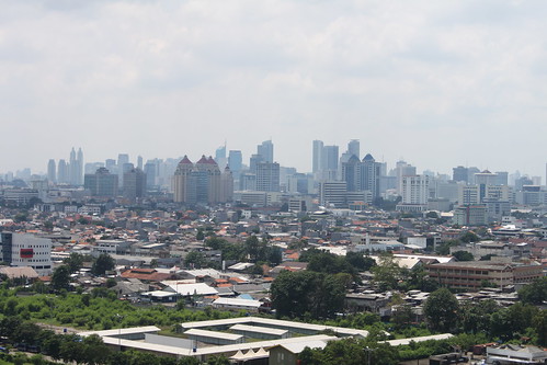
Two urban theories, the Chicago School of Urban Sociology and the Los Angeles School of Urban Geography have dominated the discourse of urban development in developing countries, including in Indonesia. Both urban theories are based on phenomenon that occurred in urban cities in the United States. The Chicago School of Urban Sociology, which was developed in the early 1920s explain the development of the urban migration that is controlled by generating ecological patterns, such as invasion, survival, assimilated, adaptation and cooperation. The Los Angeles School of Urban Geography initiated in the late 1990s to explain the development of metropolitan Los Angeles in the postmodern era that emphasizes the importance of the capitalist economic and political globalization of the economy.

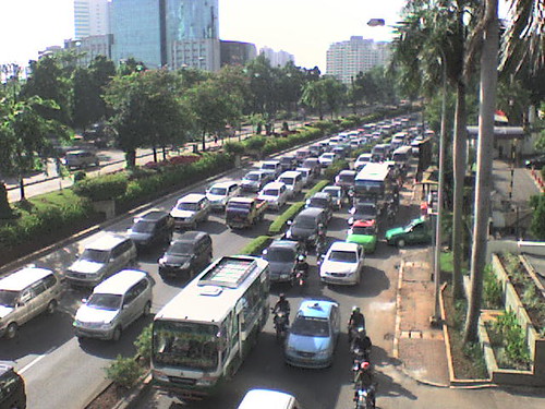
The dominance of both urban theories in the discourse of urban development influences the urban spatial planning in developing countries. Planning practices that replicate both urban theories through the dichotomy of developed and developing countries become ubiquitous. This becomes a problem when such a replication is no longer relevant with the unique urban phenomenon in developing countries, such as the informal sector.

Neither the Chicago School of Urban Sociology nor the Los Angeles School of Urban Geography can explain the unique urban phenomenon in developing countries, including the informal sector. Both urban theories are rooted from the developed world where the informal sectors or other unique urban phenomenon in developing countries are not commonly found. The local knowledge or local wisdom plays an important role in explaining the unique urban phenomenon in the developing worlds. The local knowledge or local wisdom can be an important factor in addressing any urban problems due to the unique urban phenomenon in the developing worlds.
The dominance of the Chicago and Los Angeles Schools in the practice of urban planning in Indonesia has contributed to the lack of spaces for the informal sectors in urban areas. The spaces in urban areas are dominated by the urban sectors that have high economic value and the spaces for the informal sectors are marginalized.

The application of local knowledge or local wisdom in understanding the phenomenon of street vendors will change our perspective on the existence of street vendors in urban areas. The street vendors are not the groups failed to enter the economic system in urban areas. They are one component of the urban economy that will benefit urban development. The application of local knowledge or local wisdom in the practice of urban planning will allocate more urban spaces for the street vendors and integrate it with the formal sectors.

Modifications to Urban Planning Practice

In light of postmodernist critique of the knowledge foundations of modernist planning practice and theory and the inappropriateness of the two urban theories rooted from the developed world in the developing countries, I would argue that some suggestion will likely enhance urban planning practice in the 21st century in the developing countries, particularly in Indonesia that characterized by fragmented power, distrust of government and experts, and incommensurable discourse, as follows:

  • Planning needs greater and more explicit reliance on local wisdom rather than means-end rationality.
  • Planning needs to move form top-down processes to community-based planning, geared to community empowerment.
  • Planning needs to deconstruct the public interest and community and acknowledge there are multiple publics and thus planning requires a new kind of multicultural literacy.
  • Planning needs to embrace plurality and difference. The post-modern critique calls for planner to abandon the belief that there is absolute truth or a unitary public interest.

References:

  1. Altchuler, Alan. (1965). The goals of comprehensive planning. The City Planning
    Process: 299-332.
  2. Beauregard, Robert A. (1989). Between modernity and
    postmodernity: the ambiguous position of U.S. planning. In Readings in Planning
    Theory. Scott Campbell and Susan S. Fainstein (Eds.). Malden: Blackwell
    Publishing.
  3. Beauregard, Robert A. (1991). Without a net: Modernist planning
    and the postmodern abyss. Journal of Planning Education and Research 10(3):
    189-194.
  4. Blower, A. (1986). Town Planning: Paradoxes and Prospects. The
    Planner.
  5. Dalton, L.C. (2001). Weaving the fabric of planning as education.
    Journal of Planning Education and Research 20(4): 423-436.
  6. Dalton, Linda C. (1986). Why the rational paradigm persists: the resistance of professional
    education and practice to alternative forms of planning. Journal of Planning
    Education and Research 5: 147-153.
  7. Dear, Michael J. (1986). Postmodernism and planning. Environment and Planning D: Society and Space 4: 367-384.
  8. Friedmann, John. (1987). Planning in the Public Domain: From Knowledge to
    Action. Princeton: Princeton University Press.
  9. Harper, T.L., and Stein, S.M. (1995). Out of the postmodern abyss: Preserving the rationale for liberal planning. Journal of Planning Education and Research 14(4): 233-244.
  10. Harper, T.L., and Stein, S.M. (1996). Postmodernist planning theory: The
    incommensurability premise. In Explorations in Planning Theory. Seymour J.
    Mandelbaum, Luigi Mazza, and Robert W. Burchell (Eds.). Rutgers: Center for
    Urban Policy Research.
  11. Healey, Patsy. (1997). Collaborative Planning: Shaping Places in Fragmented Society. UBC Press
  12. Innes, J. (1997). The planners’ century. Journal of Planning Education and Research 16(3): 227-228
  13. Roy, Ananya. (2005). Urban Informality: Toward an Epistemology of Planning.
    Journal of the American Planning Association 71(2): 147-158
  14. Sandercock, Leonie. (1998). Towards Cosmopolis: Planning for Multicultural Cities. London: John Wiley and Sons.
  15. Verba, Sydney, and Norman Nie. 1972. Participation in America: Political Democracy and Social Equity. New York: Harper and Row


Six elevated toll roads should be revisited

$
0
0
The Jakarta city administration will start to build six elevated toll roads in 2011 after receiving the permits from the Ministry of Public Work. In the first phase, the city administration will build two elevated toll road connecting the west and the east sides of the city including the toll road of Semanan-Sunter and the toll road of Sunter-Pulogebang. Governor Fauzi Bowo argued that the two elevated toll road would smoothen the traffic flows in the inner city toll roads. The intercity drivers would have alternative route and could avoid the congested inner city toll roads.


lanes upon lanes, originally uploaded by Ian Riley.

The other four toll roads including Kampung Melayu-Kemayoran, Pasar Minggu-Casablanca, Kampung Melayu-Duri Pulo and Ulujami-Tanah Abang will be built in next three phases. The six elevated toll roads will add 67.74 kilometers to the Jakarta’s road length and will cost Rp. 40 million (US$ 4.4 billion). Are these new elevated toll roads going to reduce the traffic congestions in Jakarta? As many critics have said about these new toll roads, the new elevated toll roads will not alleviate the traffic congestions, but will even worsen the chronic transportation problems in Jakarta.

The traffic congestion in Jakarta can't be separated from the high growth rate of vehicle ownership -- 9 to 11 percent per year -- which is not supported by the growth of road development, which is only less than 1 percent per year. The development of new roads will never meet the high growth rate of vehicle ownership. A new highway or a widened road only alleviates traffic congestion for a short period of time. After a few years, any new highway fills with traffic that would not have existed if the highway had not been built. Similarly, any widened road fills with more traffic in just a few months. Such a phenomenon is called induced demand. Because of induced demand, neither building new roads nor widening roads are viable long-term solutions to traffic congestion.


Jakarta Traffic, originally uploaded by J_K_H.

The new toll roads will also undermine the efforts of developing the mass transportation system in Jakarta. The main idea of developing the mass transportation system including busway, monorail, and the Mass Rapid Transit (MRT) projects in reducing the traffic congestion is to reduce the number of car riders and motorcyclists in the Jakarta’s streets. The car riders and motorcyclists are expected to use the mass transportation modes and reduce the burden of the Jakarta’s streets. The new toll road will attract car riders back to the Jakarta’s streets.

Not only will the elevated toll roads cause the induced demand and worsen traffic congestion, but also could jeopardize the livability of neighborhoods along the elevated the toll road. In many cities in other countries, such as Seoul, New Orleans, San Francisco and New York City, the elevated freeways caused the declining livability of neighborhoods along the elevated freeways. In many developed countries, we have seen the shift in urban planning from enhancing mobility toward promoting livability.

The Chonggyecheon freeway was completed in 1977 and was also used as a symbol of modernization and industrialization in South Korea after the Korean War. This elevated freeway was built above 5.8 kilometers creek flowing west to east through downtown Seoul. In 2000, the area was considered as the most crowded and noisy parts in the city of Seoul and became an eyesore of the city of Seoul. In July 2003, then-Seoul mayor, incumbent South Korean President Lee Myung-Bak, launched a project to destroy the Chonggyecheon freeway, revitalize the surrounding area and restore the river flow. During the demolition process of the Chonggyecheon freeway, the Seoul city administration also developed public transportation systems, including Bus Rapid Transit lines. Today, the Chonggyecheon area has been revitalized and become one of the main tourist attraction areas in the city of Seoul.


Jakarta - City Traffic, originally uploaded by sungimann.

In 1973, New York City’s West Side elevated highway collapsed and was never repaired but replaced by a surface boulevard of West Avenue. Similarly, two elevated freeways in San Francisco, Embarcadero and Central Freeways, were badly damaged by the Loma Prieta earthquake of 1989. The San Francisco city administration decided not to rebuild the elevated freeways, but replaced them with surface boulevards. The conversion of elevated freeways in both New York City and San Francisco did not cause traffic havocs. The traffic switched to the boulevards, nearby street or mass transit (James and Norquist 2010). Furthermore, a team of researchers from the UC Berkeley (Cervero, Kang, and Shively 2009) found that the conversion of elevated Embarcadero and Central Freeways with boulevard has stimulated reinvestment in the neighborhoods along the freeways without seriously sacrificing transportation performance. More recently, the residents of New Orleans have decided not to rebuild the damaged elevated expressway caused by the Hurricane Katrina, but replace it with an oak-lined boulevard (James and Norquist 2010).

The conversion of elevated freeways to surface boulevards in Seoul, New York City, San Francisco or New Orleans is evidence of a paradigm shift from a focus on expediting the movement of automobile to a focus on increasing the livability of neighborhoods. The livability of neighborhoods should be prioritized over the increase of mobility. Jakarta needs to learn from what has happened in Seoul, New Orleans, San Francisco or New York City regarding the elevated freeways. Not only is the proposed six elevated toll road projects the solution for the traffic congestion in Jakarta, but also they could cause the decline of livability of neighborhoods along the elevated toll roads. The Jakarta city administration should revisit their decision to build the new elevated toll roads and instead they should focus their efforts on building mass transportation systems in alleviating transportation problems in Jakarta.


References:
  1. Cervero, R., Kang, J., and Shively, K. (2009). From elevated freeways to surface boulevards: neighborhood and housing price impacts in San Francisco. Journal of Urbanism 2(1): 31-50
  2. James, C. and Norquist, J. (2010). Tearing down an expressway to restore a community. http://www.nola.com/opinions/index.ssf/2010/08/tearing_down_an_expressway_to.html

(This article also appeared at The Jakarta Post on September 4, 2010)

Jakarta needs Metro to avoid traffic gridlock

$
0
0
After reading the Economist magazine September 2010 issue, I realized that Jakarta had a new call: the largest city in the world without a metro. The Economist reported that the car ownerships in Jakarta have increased by 10-15 percent a year. Motorcycles are ubiquitous and can be acquired with a down payment of as little as $30. On the other hand, the growth rate of Jakarta’s road is less than 1 percent a year. The daily jams in Jakarta are getting worse. Jakarta is estimated to lose $3 billion a year due to transport delays and attain total traffic gridlock in 2014.

lalulintas jakarta metromini

Metrominis used the busway lane in Jalan Urip Sumohardjo, Jatinegara, Jakarta

The acute traffic congestion in Jakarta has also prompted President Susilo Bambang Yudhoyono to revisit the idea of capital relocation out of Jakarta. Relocating the capital out of Jakarta could reduce urbanization and the rate of car ownership in Jakarta and its surrounding areas, but it will not completely address the traffic congestion in Jakarta. Jakarta needs a fundamental change in the management of public transportation. The current public transportations have not been able to alleviate the acute traffic congestion in Jakarta. Jakarta now needs the Mass Rapid Transit (MRT) or also popularly known as Metro to address its transportation problem.

Most metropolitan areas in the world with the population of over 10 millions have operated metros for years. New York City opened the first underground line of the subway in 1904 and the subway has been the backbone of New York City transportation system since then. Two major cities in Japan, Tokyo and Osaka built their metros in 1927 and 1933 respectively. The Tokyo Metro is the world’s most extensive rapid transit system with more than eight million passengers daily. The second largest city in the world, Mexico City, has built a metro since 1969 and now the Mexico City Metro is the second largest metro system in North America after the New York City subway. Two major cities in China, Beijing and Shanghai opened their metro systems in 1971 and 1995 respectively. Major cities in Southeast Asia which have fewer population than Jakarta have also had their metro systems for years, including Manila (1984), Singapore (1987), Kuala Lumpur (1995) and Bangkok (2004) (Wikipedia, 19 October 2010).

The MRT would become the most expensive public projects in Jakarta’s history, but it is the answer to avoid the total traffic gridlock in Jakarta. For at least 20 years, the proposal of MRT in Jakarta has been discussed by the Jakarta city administration and the government of Indonesia. The activists and non-governmental watchdogs have seen the MRT proposal as a possible bonanza for corrupt politicians and contractors (Economist, 4 February 2010).

Trafic Jam - Jakarta

Acute traffic jams in Jakarta

Eventually, the government secured a $1.6 billion loan agreement with the Japanese International Cooperation Agency (JICA) in 2009 for funding the Jakarta's MRT project. Vice President Boediono has also asked the JICA to expedite the design and construction of MRT project to alleviate the traffic congestion in Jakarta. The final project designed was expected to be completed in 2011. The first tract of the MRT project was expected to connect the Hotel Indonesia traffic circle and Kota in 2016 (The Jakarta Post, 20 October 2010).

I would suggest two fundamental steps for the Jakarta city administration in order to effectively address the acute transportation problem in Jakarta. First, integrate the MRT project with the current public transportation modes including including the Transjakarta Busway, Metromini, Kopaja, Angkot, City Bus, and Mikrolet. The reliability, accessibility and affordability of the public transportation system should be improved for all levels of Jakarta residents. The development of public transportation system should also consider the needs of residents in the Jakarta’s hinterlands including Tangerang, Bekasi, Depok and Bogor.

Second, convert car riders and motorcyclists into public transport riders/MRT riders. This would be the critical key for the Jakarta's success in overcoming the traffic congestion. Without the conversion of car riders and motorcyclists into public transport riders/MRT riders, the traffic congestion in Jakarta would never be resolved and the MRT project would be an ineffective investment.

Going Home

Metro in Montreal

The conversion of car riders and motorcyclists into public transport/MRT riders is not an easy thing to accomplish. A careful and comprehensive planning that involves various stakeholders is needed. The Jakarta city administration also needs to learn from the experience of the Transjakarta Busway operation particularly on how to effectively convert car riders into the Transjakarta Busway riders. Last but not least, the inconvenience of car riders and motorcyclists due to the acute traffic congestion in Jakarta could be considered as a great asset for converting them into public transport/MRT riders. The public transport and MRT system should offer reliable, accessible, punctual, comfortable, safe and affordable transportation modes in order for car riders and motorcyclists to leave their vehicles and ride public transport and/or MRT as their primary transportation modes.

(This article also appeared at The Jakarta Post on October 24, 2010)


Concerted steps to disentangle Jakarta traffic congestions

$
0
0

Many policies have been offered by the central government and the Jakarta city administration to disentangle the Jakarta chronic traffic congestions. Vice President Boediono, after the meeting with several ministers and the Jakarta Governor Fauzi Bowo on September 2, 2010, offered 17 policies to alleviate the Jakarta worsening congestion. Those policies include (1) the application of electronic road pricing (ERP), (2) the sterilization of Transjakarta lanes, (3) the improvement of on-street parking management, (4) multiyear contract for road maintenance, (5)the addition of two more Transjakarta routes by the end of 2010, (6) subsidies for natural gas usage by public transportation modes, (7) incentives for converting old minivans into new buses, (8) reactivation of commuter train routes in Jabodetabek, (9) punishment for illegal public transportations, (10)MRT, monorail and railroad access to the airport should be prioritized, (11) the creation of Transportation Authority of Jabodetabek, (12) the revision of the Integrated Transportation Master Plan of Jabodetabek, (13) the hastening of double tract project in Jakarta’s suburb areas, (14) development of the Jakarta inner-ring railroad, (15) the development of six new inner city toll road, (16) limitation of vehicles on the road, and (17) the provision of parking lots around Transjakarta stations and commuter train stations (The website of the Indonesian Vice President Office, September 2010). At the meeting, Vice President Boediono appointed the head of the Presidential Work Unit for Development Monitoring and Control (UKP4), Kuntoro Mangkusubroto, to head the team addressing the Jakarta’s transportation problems (The Jakarta Post, September 3, 2010).

Late Traffic in Jakarta

In addition to the long list of policies from Vice President Boediono, the Jakarta city administration added some more policies to alleviate the traffic congestion in Jakarta including changing traffic regulations in some areas (The Jakarta Post, September 24, 2010), staggering office hours according to municipality (The Jakarta Post, November 3, 2010), and forming a task force to be deployed to traffic congestion hot spots (The Jakarta Post, November 6, 2010).

The development and expansion of mass transportations including MRT, monorail, Transjakarta, train to the airport and commuter trains in inner-city and suburbs of Jakarta, as recommended by Vice President Boediono, are the fundamental key to disentangle traffic congestions in Jakarta. Such developments should be prioritized and expedited. The traffic congestion management including the application of ERP, the traffic law enforcement and the deployment of task forces to traffic congestion hot spots will also support the effectiveness of mass transportation in alleviating the transportation problems in Jakarta.

The Jakarta Transportation Agency has planned to apply the ERP in major thoroughfares which currently use the three-in-one system (The Jakarta Post, September 23, 2010). The ERP is used to impose automatically a demand sensitive congestion toll when the congestion level in the restricted zone exceeds a preferred threshold level. Only drivers with the high value of their trips will pay the charge. As a result efficient use of the road and redistribution of trips spatially, temporarily and modally will occur (Albalate and Bel 2009; Goh 2002).

Jakarta needs to learn from the success of Singapore that has implemented the ERP since April 1998. The ERP in Singapore is the upgrade system of the previous congestion measure, Area Licensing Scheme (ALS) that was introduced in 1975. The implementation of ALS reduced the traffic by 45 percent during the morning peak and another 15 percent after the introduction of the ERP. One of the contributing factors to the success of the ERP implementation is the strong commitment of the Singaporean authorities to develop and expand public mass transportation alternatives (Albalate and Bel 2009). Other cities including London and Stockholm that have successfully implemented traffic congestion charging measures also have reliable, accessible and affordable public transportation alternatives.

Jakarta Traffic

Among the policies proposed by Vice President Boediono and the Jakarta city administration, I found two policies that could be counterproductive to the development and expansion of mass transportation system: the development of six new inner-city toll roads and the staggering office hours. Both policies could ease the traffic congestions in the short run, but could cause more traffic congestions in the long run. The policies will not encourage drivers to convert from their vehicles to mass transportation as their primary transportation modes. They will only undermine the efforts of developing the mass transportation system in Jakarta.

Alternatively, many possible policies could be implemented in Jakarta in order to alleviate the traffic congestion including shuttle services, carpool matching services, telecommuting and downzoning. Instead of staggering office hours, the Jakarta city administration should encourage private and public companies to expand their shuttle services and develop carpool matching services for their employees.

Telecommuting is a way to reduce commuting by using telecommunications technologies. Employees can work outside the traditional office at remote work locations including their homes. A study in the US shows that telecommuting can reduce commuting for about 10.4 percent of the labor force (Cullingworth and Caves 2009). Downzoning is a measure to reduce allowable development on land zoned for service, retail or commercial development. Such a measure is mostly directed to areas along busy streets to reduce traffic congestions.

In order to support the development and expansion of mass transportation system, Jakarta also needs to develop more multimodal transportation districts. Such districts provide a mix of land uses, an interconnected network of streets designed to encourage walking and bicycling, and appropriate densities and intensities of land uses within walking distance of transit stops (Cullingworth and Caves 2009).

Jakarta is estimated to lose $3 billion a year because of traffic congestions. Concerted steps are needed to reduce the Jakarta’s traffic woes. These steps must be implemented with a strong commitment to develop and expand an integrated, reliable, accessible and affordable mass transportation system in Jakarta.

(This article also appeared at The Jakarta Post on November 13, 2010)


References:

  1. Albalate, Daniel and Bel, Gelma. (2009). What local policy makers should know about urban road charging: Lessons from worldwide experience. Public Administration Review 69(5): 962-975.
  2. Cullingworth, Barry and Caves, Roger W. (2009). Planning in the USA: Policies, Issues and Processes. London and New York: Routledge.
  3. Goh, Mark. (2002). Congestion management and electronic road pricing in Singapore. Journal of Transport Geography 10: 29-38.

Jakarta's city planning: What can we do and what can we expect?

$
0
0
City planning can be defined as a systematic attempt and action in the public domain to shape the future of urban areas. City planners are expected to collect and analyze data about every aspect of a city, including transportation, the environment, natural resources, land use, housing and the community, as well as economic development, manufacturing, commercialization, tourism and historic preservation. After the data has been collected and analyzed, city planners work with city stakeholders, including residents, to determine the plans for the city. The plans are to guide present and future city growth in order to create a better place to live. This is also what we should expect from Jakarta’s city planning. We should expect Jakarta to become a better place to live.

We have witnessed a Jakarta plagued by two major problems in the last few years: traffic congestion and floods. Despite several programs to alleviate traffic congestion and flooding, the severity of traffic and flooding in parts of Jakarta has not decreased. This is strong evidence that previous Jakarta city planning has failed to create a better Jakarta for its residents.

Heart of Jakarta, originally uploaded by DocBudie ツ.

We need bold steps to plan the future of Jakarta in order to address the traffic congestion and flood problems. It is estimated Jakarta loses US$3 billion a year due to transport delays, and will have total traffic gridlock by 2014. The floods that inundate many parts of Jakarta every year also cause the loss of billions of dollars.

Many people believe the cause of traffic congestion is that roads don’t grow in conjunction with the increase in vehicle ownership. In Jakarta, vehicle ownership increases by 9 to 11 percent per year, but the growth of roads is less than 1 percent a year. But developing new roads is not the solution to traffic. When a new highway is built or a road is widened, it only alleviates traffic congestion for a short period of time. After a few years, any new highway fills with traffic that would not have existed if the highway had not been built. Such a phenomenon is called induced demand.

The viable solution for the traffic in Jakarta is to develop an integrated, reliable, accessible and affordable public transportation system. The poor public transportation system is the cause of the traffic congestion in Jakarta. Residents in Jakarta use their vehicles, either cars or motorcycles, as their primary transportation because the public transportation in Jakarta is unreliable, inaccessible and expensive. That’s why cars and motorcycles crowd Jakarta’s streets. In 2009, the number of modes of public transportation was only about 1.5 percent of the total number of vehicles in Jakarta.

The Jakarta administration failed to develop an integrated, reliable, accessible and affordable public transportation system and it caused the chronic traffic in Jakarta. Jakarta was late to develop a Mass Rapid Transit (MRT). For at least 20 years, the MRT proposal was discussed by the government and was seen as a possible bonanza for corrupt politicians and contractors before a $1.6 billion loan was secured from the Japanese International Corporation Agency in 2009.

Jakarta at Night, originally uploaded by Msbernal.

Other metropolitan cities in Southeast Asia that are smaller than Jakarta have developed their own MRTs for years, including Manila (1984), Singapore (1987), Kuala Lumpur (1995) and Bangkok (2004). The first track of the MRT project is expected to connect the Hotel Indonesia traffic circle and Kota in 2016. Jakarta needs to integrate this expensive project with the TransJakarta Busway, the public minibuses Metromini and Kopaja, public minivans and the city bus. The next step, which is critical for Jakarta’s success in easing traffic, is to convert car riders and motorcyclists into public transport riders and MRT riders.

In addition to developing the MRT, Jakarta needs to implement other innovative methods to ease traffic congestion, including electronic road pricing, shuttle services, carpool matching services, telecommuting, downzoning and better parking management in downtown areas. Jakarta also needs to develop more districts with a mix of land uses and an interconnected network of streets designed to encourage walking and bicycling.

Floods are not a new problem for Jakarta. Jakarta is hit by deadly floods every year. The annual floods inundate many parts of Jakarta and paralyze the center of Indonesia’s economy. The annual floods kill many people and cause thousands of Jakarta’s residents to flee their homes. In the last four years, the deadly annual floods occurred in the month of February when rainfall in Jakarta is at its highest.

In February 2010, annual flooding from the overflowing Ciliwung River killed at least two people and displaced more than 1,700 in the Kampung Melayu, Bukit Duri and Bidaracina areas. This year’s floods in Jakarta inundated more areas than last year’s floods, despite less rainfall and the completion of the East Flood Canal.

More recently, thousands of commuters were stuck for hours in Jakarta’s gridlocked streets because of three hours of heavy rain that caused floods and paralyzed roads and train traffic on Oct. 25. At least two people were also killed by the flood.

The annual floods in Jakarta are strong evidence that Jakarta has not been able to sustainably accommodate its growth. Two centuries ago, the Dutch colonial government built a system of canals to protect the city’s population, which was then 500,000. Jakarta, which lies in a lowland area with 43 lakes and 13 rivers, relies on the canal system to prevent flooding.

Today, Jakarta is a megacity with a population of nearly 10 million within the city’s boundaries and more than four million in neighboring areas; yet, it still relies on the same canal system to avert flooding.

Rapid urbanization in Jakarta must be slowed. One possible way to reduce urbanization in Jakarta is to redistribute the central functions of Jakarta to other parts of the nation, and to strengthen other urban agglomerations in Indonesia to pull urban growth away from the capital.

Water catchment areas, green areas and wetlands that have been converted into urbanized areas need to be re-functionalized as non-urbanized areas. In the 1970s, green areas made up between 40 and 50 percent of Jakarta and have been shrinking ever since. Green areas in Jakarta in 2010 account for only 9.3 percent of the city’s area.

(This article also appeared at The Jakarta Post on December 20, 2010)

Planning theory derived from planning practices in Indonesia

$
0
0

The gap between planning theory and practice has been identified for years (Alexander 1997; Brooks 2002; Sanyal 2002). Planning practice and planning theory have two distinctive communities of interest (Brook 2002). None of planning practitioners who participated in the survey conducted by MIT found planning theory useful when they grappled with conflicting interests (Rodwin and Sanyal 2000). Friedmann (2003) asserted that most planners go through their education without a clear understanding of planning theory.

The language of planning theory is abstract, esoteric and highly technical for most planning practitioners (Brook 2002). Most ideas of planning theory have not engaged planning practitioners constructively and planning theorists communicated their ideas to others who share their interests (Brooks 2002). It’s clear that we should bridge the theory and practice gap. Bridging the theory and practice gap is important because planning theory is fundamental to the planning profession. Planning practitioners need to understand the epistemological underpinnings of their actions. There is no planning practice without a theory about how planning ought to be practiced (Friedmann 2003).

In a more recent article, Friedmann (2008) identified three major ways of how planning theory can contribute to the advancement of planning practices. First, philosophical way that evolves humanist philosophy for planning and traces its implications for planning practice. Second, adaptation way that helps adapt planning practices to the real constraints including scale, complexity and time. Third, translation way that translates knowledge and ideas from other fields into the domain of planning.

There are four types of planning theory based on the basis of their intent (see Alexander 2003; Brook 2002 and Friedmann 2003). First, theories about planning that focus on its role in a particular milieu, i.e. community, nation or society and are based on empirical study or experience of practice. Second, theories for planning that propose models or strategies for planning practitioners to consider or use. Third, theories in planning that focus on the subject or objects of the planning undertaking. This type of theory is used in planning practices and is specific to its several specializations, i.e. community development, land use, transportation, environmental planning, etc. Fourth, theories of planning that address what is common to all planning specializations and explicate characteristics of planning practice.

Theories of planning are said to be irrelevant to planning practice (Friedmann 2003; 2008). Furthermore, Alexander (2003) argued that diversity of practices in planning and different types of planners in different contexts complicate the relevance of theories of planning for planning practice. The gap between planning practice and planning theory occurs specifically between planning practice and theories of planning.

Most planning theories were developed and extended within the context of Western liberal democracies. What is the relevance or the applicability of those planning theories to planning practice in different contexts is one of the most interesting theoretical and practical conundrums in planning. What about the gap between planning theory and planning practice in Indonesia? There has not been any study to investigate the gap between planning theory and practice in Indonesia, but I can assure that there is gap between planning theory and practice in Indonesia. Planning theory is also taught to students in the planning schools in Indonesia but I’m not sure the relevance of planning theory for planning practitioners in Indonesia.

This post attempts to bridge the gap between planning theories and practice in Indonesia. Needless to say, this is a daunting task. This is just the beginning of a long journey of bridging planning theories and planning practice in Indonesia.

I identify at least four articles about planning theory derived from planning practice in Indonesia. Beard (2002) developed covert planning for social transformation that was drawn from a longitudinal study of informal settlements along the Code River, Yogyakarta. A case study of a local youth group that planned and maintained library in the informal settlements along the Code River was used to illustrate the concept of covert planning that was defined as a “covert, incipient and incremental form of planning” (Beard 2002).

Drawing on the same study of informal settlement along the Code River, Yogyakarta, Beard (2003) extended radical planning in restrictive political environments. She used three local-level planning cases including the development of a health care clinic, the pavement project and the library project by residents in the informal settlements along the Code River to explain how the foundation for radical planning evolved in authoritarian contexts.

Hudalah et al (2010) explored ideas about communicative planning and capacity building in collective action. They combined political opportunity structure and Kingdon’s policy window and developed an agency-centered approach to opportunity. The extended ideas about communicative planning and capacity building were applied to two debates on development planning projects in the periurban area of North Bandung Area, Indonesia.

Hudalah et al (2011) extended the potential of policy networking as capacity building. They explained how a planning policy network is constructed and how it can improve the governance that faces spatial, social and institutional fragmentations. The debate on the road development proposal in North Bandung Area, Indonesia was used to illustrate their extended policy network as capacity building.

In addition to the articles about planning theories derived from planning practices in Indonesia, I will present ideas from Bambang S. Priyohadi (BSP), an Indonesian planner who has more than 30 years of planning experiences in the Department of Public Works and in the Province of Yogyakarta. BSP theorized his planning experiences in a thread of discussion in the Referensi list-serve. BSP argued that planning is a model of communication. Planning and policy executor are on the same side and expected to serve community and the nature on the other side.

BSP characterized planning in four ways including planning is an endless communication, planning is selling ideas, planning is constructing hopes and planning is sharing believes.

Planning is an endless communication. BSP argued that planning is a process that will still continue even when the plan is completed. Planning has not started when “the planning law or ordinances has been passed” or “the plan has been completed”. Planning will only end when the civilization is over. The discrepancies between the planned and the real conditions will likely occur and they are unpredictable. Using the unconditional cash transfer program (BLT), the disaster donation in Bantul and the development of agricultural areas in Samas-Pandansimo, BSP indicated unpredictable outcomes that were not identified in the plans. In the case of BLT, the outcomes are the panders (calo) who get personal advantages from the cash transfer coupons. One of unpredictable outcomes of the disaster donation in Bantul is the increase of motorcycle sales. The unexpected outcome of the success of development in Samas-Pandansimo is the increase of prostitute from about 60 to more than 500 in 3 years.

Planning is selling ideas. The presentation techniques have been learned by the planning practitioners from planning schools, but the planning practitioners also need to sell their ideas effectively. Selling an idea is not always about the excellent presentation technique but more importantly also about the right attitude and thought. BSP identified several factors to be considered in selling ideas effectively including customer language, understanding of the customer needs, communication techniques, communication intensity, and message clarity.

Planning is constructing hopes. Planners often consider their plans as the best representation of the community’s expectations. In fact, the plans are mostly created within the context of different sense of priority and the background of the planners. Planners are expected to meet the expectations or the hopes of the community.

Planning is sharing beliefs. Building trust is the important prerequisite in the planning process that is often neglected by the planners. Using his experience when working with residents of Ngawen in Gunung Kidul Regency, BSP was able to develop an effective mutual relationship with them and produce the expected results through sharing a very strong belief with them.

References:

  1. Alexander, E.R. (1997). A mile of a millimeter: measuring the planning theory-practice gap. Environment and Planning B: Planning and Design 24(1): 3-6
  2. Alexander, E.R. (2003). Response to ‘Why do planning theory?’ Planning Theory 2(3): 179-182
  3. Beard, V.A. (2002). Covert planning for social transformation in Indonesia. Journal of Planning Education and Research 22(1): 15-25
  4. Beard, V.A. (2003). Learning radical planning: the power of collective action. Planning Theory 2(1): 13-35
  5. Brooks, M. (2002). Planning Theory for Practitioners. Chicago: APA Press.
  6. Friedmann, J. (2003). Why do planning theory? Planning Theory 2(1): 7-10
  7. Friedmann, J. (2008). The uses of planning theory: a bibliographic essay. Journal of Planning Education and Research 28: 247-257
  8. Hudalah, D., Winarso, H., and Woltjer, J. (2010). Planning by opportunity: an analysis of periurban environmental conflict in Indonesia. Environment and Planning A 42(9): 2254-2269
  9. Hudalah, D., Winarso, H., and Woltjer, J. (2011 forthcoming). Policy networking as capacity building: an analysis of regional road development conflict in Indonesia. Planning Theory
  10. Rodwin, L. and Sanyal, B. (eds.). (2000). The Profession of City Planning. Rutgers, NJ: Center for Urban Policy Research
  11. Sanyal, B. (2002). Globalization, ethical compromise and planning theory. Planning Theory 1(2): 116-123

Jakarta Annual Flooding in February 2011

$
0
0
Since I started this blog in January 2007, I have recorded all floods in Jakarta in this blog. Interestingly, the worst floods occured in Jakarta during the month of February when rainfall in Jakarta and other areas in Indonesia was at its highest and floods become a threat for residents.

INDONESIA/, originally uploaded by jtcemmadna.

In February 2007, the flood inundated about 70 per cent of the Jakarta's area. It killed at least 57 people and sent about 450,000 fleeing their homes. The city's hospitals struggled with an influx of patients suffering from diarrhoea, dengue and severe respiratory problems. The flood paralysed the centre of Indonesia's economy for several days and businesses claimed to lose about US$1 billion.

In February 2008, 37 of 267 subdistricts in Jakarta were inundated by more than 40 centimeters of water. Floodwaters caused public transportation, including the busway lines across Jakarta, to stop operations, leaving thousands of passengers stranded. The flood also inundated the Sedyatmo toll road to Soekarno-Hatta International Airport, which resulted in the cutting off the highway for a few days. Nearly 1,000 flights were delayed or diverted and 259 flights were canceled.

In February 2009, the floods inundated many parts of Jakarta including sub-districts Bidara Cina, Kampung Melayu, Cawang, Bukit Duri, Angke, Petamburan, Tanjung Priok, Kelapa Gading, Koja, Cilincing, Rawa Badak, Kamal Muara, and Kapuk Muara. These areas were inundated by between 10 and 50 centimeters of water. Floodwaters also caused lengthy traffic jams in many main streets in Jakarta.

In February 2010, the floods inundated more areas than the previous year’s floods despite a lower level of rainfall. The flood in February 2010 also killed at least 2 people and displaced more than 1,700 in Kampung Melayu, Bukit Duri and Bidaracina areas from overflowing Ciliwung river.

In February 2011, the worst flood inundated Jakarta on February 15, 2011 that caused severe flooding in the neighborhood of Jl. Gunung Sahari and a 50-centimeter-deep flood that submerged the main road connecting Mangga Dua Square and the Ancol amusement park. The flooding also affected TransJakarta buses bound for Ancol (The Jakarta Post, February 16, 2011).

The East Flood Canal project has been completed and reached the sea on December 31, 2009. This massive project was considered as the most feasible solution for preventing future floods in Jakarta, but it clearly cannot prevent the flooding entirely. Neither dredging the canals and rivers nor building new canals is a sustainable solution for preventing future flooding in Jakarta. The annual floods are strong evidence that Jakarta cannot sustainably accommodate its rapid growth.

Jakarta's skyline , originally uploaded by Deden Rukmana.

Interestingly and not surprisingly, many Jakarta's residents have been used to flooding and have made it as part of their daily life as you can find in the following story from The Jakarta Post on January 5, 2011:

Two children chased each other cheerfully, splashing about in polluted water flowing through a small alley in Muara Angke, Pluit, in North Jakarta, while their mother watched television in their home nearby. Their mother, Carini, in an effort to stop water from flooding their home, had deployed a few sacks of charcoal as a barrier. After all, she made no bones about the floodwaters that regularly inundate her home. She and her family members had already made peace with the floods, she told The Jakarta Post.

“We even use floodwater to wash our clothes if the water looks clean,” she said. Carini knows by heart what time the water will start rising.

“Every day the water rises at 8 a.m. until around 10 or 11 p.m,” she said, adding that the water could at times be ankle-high.

Before she decided to elevate her home’s floor last year, floodwaters had been as much as 1 meter high. Carini has been living in the fishing village of Muara Angke for the past 12 years, and insists she will remain there in spite of the perennial inundation. Her home is where their livelihood is as her husband is a fisherman who sets sail from the seaside village.

Muara Angke is one of 27 sites in North Jakarta that are prone to tidal flooding, including Penjaringan, Kapuk Muara, Tanjung Priok and Ancol. The frequent flooding occurs because the elevation of the fishing village is slightly lower than sea level. Compounding the problem is the mounds of garbage that block the passage of water in nearby streams. Sumri, a food vendor at the nearby Muara Angke traditional market, said the aqueduct that channels tidewater was clogged with garbage.

“[The flooding] has never subsided. The best we can hope for is ankle-high flooding,” she said. Sumri said although she and her family were used to the flooding, it could be very disruptive at times, especially during bathing hours.

“My toilet is in the back of the house, so I have to pass the water every time I go there,” she said.

Subandi, Sumri’s brother-in-law who also lives in the home together with his wife and son, said the toilet was 30 meters away.

“To avoid any skin problems we always wash our feet after returning from the toilet,” he said.

Sumri said living so close to water also forced them to spend more on water. She buys clean water once every two days. “We need it for drinking and cooking.”

Despite the persistent garbage, the authorities have done little. “I can’t remember the last time the aqueduct was cleaned. The last time it was cleaned was when the head of the neighborhood initiated a cleanup,” Subandi said.

“I don’t think the subdistrict administration wants to do a cleaning job,” he said, laughing.

The lack of initiative from the local government has prompted residents to deal with the flooding on their own. On Jl. Cumi, an alley next to the Pluit Port that is regularly flooded, residents built an embankment from debris they collected to stop tidal water from flowing into their neighborhood.

The above story illustrates the responsiveness of the Jakarta's residents to flooding. They are the victims and also the "real solution" to the annual flooding in Jakarta. They are willing to sacrifice their life for finding the solution to the annual flooding. It's sad but this is what has been happening in Jakarta for years.

Promoting Bike Lanes in Jakarta

$
0
0
On May 22, 2011, Jakarta set a new milestone towards a healthier and more livable city. The Jakarta administration inaugurated the first Jakarta’s dedicated bicycle lane stretching 1.5 kilometers from Ayodia Park to Blok M in South Jakarta. Jakarta is late in promoting bicycle lanes. Jakarta has focused in promoting the use of cars by building more elevated inner city toll roads and ignored the importance of non-motorist trips in the city.

Jakarta's Traffic This Morning, originally uploaded by Chandra Marsono.


Many metropolitans in the world have developed dedicated bicycles lanes for years. Cities in developed countries, particularly in Europe, have integrated bicycle lanes into their transportation network systems. Those cities such as Amsterdam, Paris, Berlin, Copenhagen and Barcelona have been developed as bike-friendly cities. Safe and extensive bike route networks, promotion of pro-cyclist policies, and a bike culture have taken places in those cities. Cyclists in those cities are not second class residents and can safely ride their bicycles as the main mode for their daily commute to their workplaces. Copenhagen is an example of European bike-friendly city where about a third of workforce in this city commute to the office by bike.

The inauguration of the first Jakarta’s dedicated bike lane stretching from Ayodia Park to Blok M should also be considered as a breakthrough in solutions for acute traffic congestions in Jakarta. The development of dedicated bicycle lanes is a good move from the Jakarta administration for promoting the use of bicycle as an alternative transportation mode. If the Jakarta city administration could encourage more motorists to shift to using bicycle to work, the city’s chronic traffic woes could be eventually reduced.


Bike Lane and Traffic Lights, originally uploaded by Mikael Colville-Andersen. Some Copenhageners on their way home in the afternoon, along the busiest boulevard in the capital, Hans Christian Andersen's Boulevard. Over 20,000 bikes a day on this stretch and this intersection is among the busiest in the kingdom. Notice the abundance of traffic lights, for extra safety. Cyclists here have three lights to look at. Helpful if you're stuck at the back of a queue of 50-75 bikes. You'll always be able to see one.

The first dedicated bike lane in Jakarta is only a small step in developing Jakarta as a bike-friendly city. There are many challenges for Jakarta to be a bike-friendly city. The Jakarta city administration needs to have a strong commitment to build more dedicated bike lanes and integrate them with the city transportation network system. Dedicated bike lanes should be part of the city transportation network system and designed to accommodate the need of residents’ mobility in the city. It is very essential to connect dedicated bike lanes with mass transportations including the Mass Rapid Transit (MRT).

It’s not easy to build more dedicated bike lanes if the Jakarta city administration still focuses on building more elevated inner-city toll roads as the solution of addressing the chronic traffic woes in Jakarta. It is also important to note that the first dedicated bike lane was not initiated by the Jakarta city administration but the Indonesian Bicycle Community (Komite Sepeda Indonesia) that donated as much as 500 million rupiahs to build the bike lane. The Jakarta city administration needs to change the mindset of the possible solution for the chronic traffic congestion in the city. The solution is not building more roads, but reducing the use of cars through improving and expanding the use of mass transportations and bicycles.

Another big challenge for bike lanes in Jakarta is the lack of law enforcement. The Jakarta city administration should strictly enforce the dedicated bike lanes for cyclists. The dedicated bike lane cannot be used as parking spots and a lane for motorcyclists. A few days after the inauguration of the bike lane stretching from Ayodia Park to Blok M, the lane was overwhelmed by private cars, pubic minivans and three-wheeled vehicles bajaj. A number of private cars were also parking in the lane (The Jakarta Post, 27 May 2011). Without strict law enforcement, the dedicated bike lane will not be an effective way to reduce the Jakarta’s traffic woes and will only be a failed initiative.

Velib' bikes, Paris, originally uploaded by the noggin_nogged.

Despite the challenges for bike lanes in Jakarta, the inauguration of the Jakarta’s first bike lane should be seen as a promising way of alleviating the acute traffic problems in Jakarta. I hope that the inauguration of the Jakarta’s first bike lane could be the milestone for the Jakarta city administration in changing the mindset of how to address the chronic traffic problems in Jakarta. It is not building more toll roads but reducing the use of cars through encouraging more motorists to shift to cyclists or mass transportation riders.

(This article was also reposted at Berburu Center on June 14, 2011 and at This Big City on October 17, 2011)


Viewing all 43 articles
Browse latest View live


Latest Images